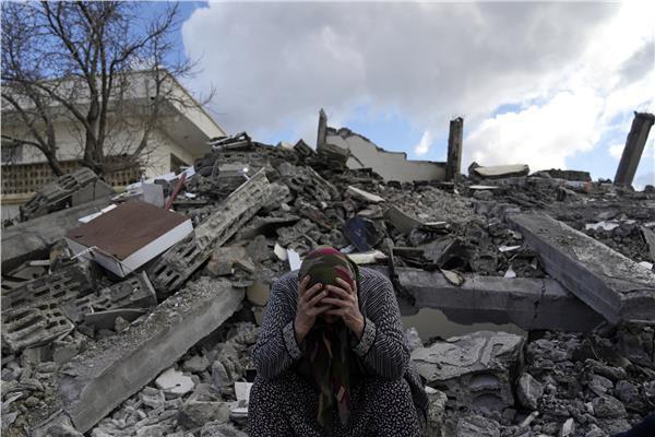
نشرت شركة "ماكسار" الأمريكية للتصوير بالأقمار الاصطناعية، على حسابها الرسمي في تويتر، صورا تكشف آثار الدمار الواسع جراء زلزال تركيا وسوريا .
اقرأ أيضًا|ارتفاع حصيلة ضحايا الزلزال في تركيا إلى 14 ألفا و351 وفاة
We will be activating our Open Data Program (https://t.co/KG4Ln7Gvck) for the powerful #earthquakes in #Turkey and #Syria. Please stay tuned for that notification. Seen here is another before (Oct 4, 2022) and after (Feb 7, 2023) view of #Islahiye, Turkey and the destruction. pic.twitter.com/jd8KakGRgb
— Maxar Technologies (@Maxar) February 7, 2023
وتكشف صور الأقمار الصناعية الدمار الكبير في المناطق المتضررة من الزلزال ولعل أحد هذه المناطق أنطاكيا التركية حيث تضررت أحياء بأكملها.
New satellite images from today, February 8, of areas in #Antakya, #Turkey that have been heavily affected by the recent #earthquake. Damage can be seen throughout the area, particularly with numerous high-rise apartments buildings that have collapsed. pic.twitter.com/zhK9WnJYtS
— Maxar Technologies (@Maxar) February 8, 2023
وقبل الكارثة، كانت المنطقة عبارة عن حي سكني واسع محاط بمناطق خضراء، قبل أن يدمر الزلزال القوي مساحات شاسعة ويسقط مجموعة بنايات.